 If you have any interest in the ancient cities and archeological sites of Southeast Asia, you will already know of Angkor, and of its best known temple Angkor Wat. Angkor was the urban area at the heart of the Khmer Empire of Cambodia during the Angkorian Period (802-1431).
The city was first established in 891 with construction of a temple on the top of the hill which stands directly west of Angkor Wat. In 928 the capital was moved 100 km north, and twenty years later returned to Angkor. From that time until 1431 this city served as the center of the Khmer Empire.
At its height the population may have reached one million. Roads and canals served an area of 386 sq mi (wiki). After Ayutthaya conquered Angkor, much of the city was reclaimed by jungle, though parts of Angkor Wat remained in use. Interest in Angkor was rekindled with the publication of the notes of a French naturalist in 1863, and the city has since been explored, then researched, preserved and restored. Many countries have contributed to these efforts with the French at the forefront.
Here are some glimpses of Angkor.  These photos give only a hint of the what it is to explore Angkor. The sheer scale must be experienced. The endless corridors of Preah Khan housed a university. Temples are decorated with sculpture, both free standing and integrated into the facades. The beautiful bas-reliefs of Angkor Wat line over a third mile of the inner wall. The wonders are compelling and I spent four days exploring in February, mostly by bike, and most often in the mornings before the afternoon heat.
Angkor Wat


Angkor Thom
Angkor Wat is the first site reached when entering the urban area of Angkor. Past that, the road approaches the fortified city Angkor Thom and its south gate. On top of the hill to the left is Phnom Bakeng. This area is jammed with vendors and is the starting point for elephant rides up to that first Angkorian temple.
Past the vendors is a causeway over a moat with a naga railing. It is carried by stone asuras (demons) as in the views shown here, and by gods on the other side.


Each of the five gates into the walled city of Angkor Thom bears four sculpted heads, one at each cardinal point. These heads on the south gate are some of the most complete remaining. In the photo above, the approaching line of tuk tuks reveals the scale of these gates. The photo below shows the current condition of the faces.

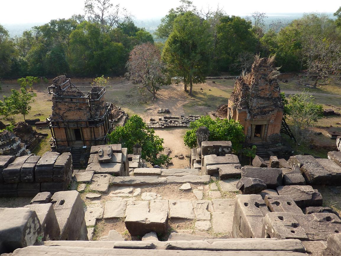
Inside the walls of Angkor Thom, the structures which survive were the temples and palace buikdings. Only stone and brick structures remain in Angkor; all else is gone. Here you will find the Bayon – the state temple built by King Jayavarman VII adorned by 216 stone heads, the Royal Palace, an earlier state temple – the Phimeanakas, the Elephant Terrace and the Terrace of the Leper King, as well as many lesser known sites.
The Bayon stands in the exact center of Angkor Thom.
Unlike Angkor Wat which looks impressive from all angles, the Bayon looks rather like a glorified pile of rubble from a distance. It is only when you enter the temple and make your way up to the third level that its magic becomes apparent.
–Lonely Planet Cambodia:


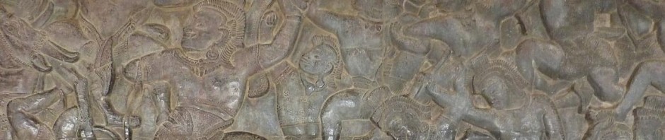
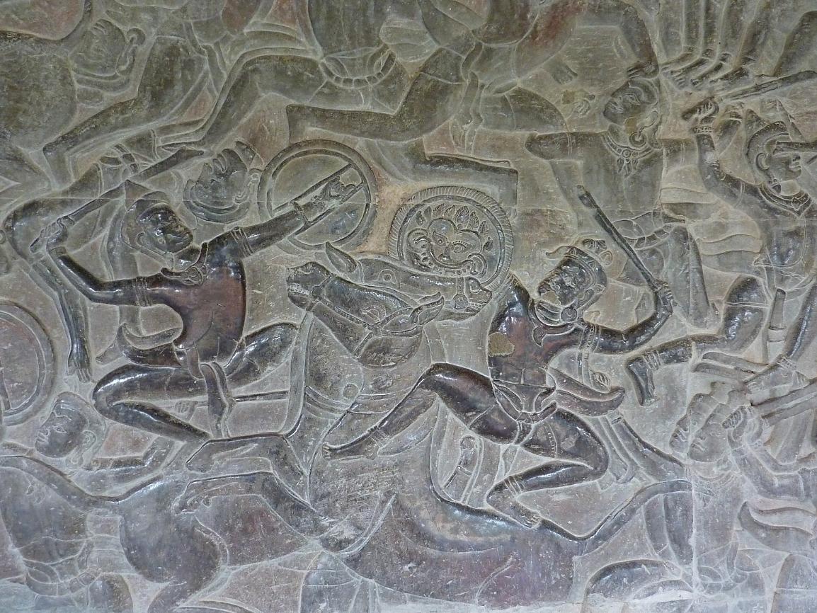
 As in Angkor Wat, the Bayon features extensive bas-reliefs. Those at Angkor Wat recount several Hindu epics, the procession of King Suryavarman III and the Heavens and Hells. The bas-reliefs at the Bayon depict Khmer-Cham war scenes and scenes of everyday life.
The styles are quite different: examples from Angkor Wat are at the right, and at the top of this page. Below is an example from the Bayon.

The urban area of Angkor encompasses a vast site. Just as it takes several days to see any significant part of it, so does it take more than one post to recount. Thus I will save a look at Ta Prohm, Preah Khan, and several other sites for another time.